Saturday, April 30
 Running with glee at Apache Creek Campground, Gila National Forest, New Mexico
Bridget, Reggie, and I don’t want to leave Apache Creek!
The crew loves the flat, open space with the dog-pleasing smells of piney forest. As for me, I want to see and photograph the abundant wildlife and birds that have been under cover due to our arrival and the rain.
This morning at first potty break, unseen turkeys gobble in the thicket near our camp and nearly drive Reggie out of his ever-lovin,’ canine mind. He must think they’re monsters!
Why do we have to leave?
No internet! Nothing. I’m unable to go online at all. My blog is very important to me and I don’t want it to languish from lack of attention. I don’t want my neglect to undo the work it took to build it to its present level of popularity. The income it provides via Amazon sales is also important to me. When I don’t post, sales plummet.
The crew and I ride over to Apache Creek Store.
 While sitting in the Perfect Tow Vehicle, I turn on my Verizon jetpack air card.

As expected it searches for a signal and fails to find one. Apache Creek is surrounded by steep hills and mountains very close-in. I’d put up the Wilson antenna, but it can’t boost a signal that doesn’t exist.
Darn. Well, we’ve camped at Apache Creek for two nights. We’ll stay one more night.
“Guess what, crew. Early tomorrow morning we’re off to a new camp!”
Sunday, May 1
The crew and I take Route 32 toward Quemado. The two-lane road curves around a hillside. I hit the brakes.
What’s this? Oh, wow . . . elk!
 Elk are everywhere!

Several are in a field on our left, gathered in small groups.
 I bring down the window and aim my camera.
Zoom!
 Elk are also on the slope to my right which is in heavy shade because the sun has not yet “cleared” the hill. Those photos don’t come out very well.
A doe (oops! a female elk is called a cow) jumps a fence to join others on the shady slope.
She stops to look us over. Being familiar with deer more than with elk, I make comparisons.
Much bigger, a long neck, heavy torso . . .
 Powerful, muscled flanks . . . a camel-like pose of the head . . . . not as lithe as a deer . . .
 Bridget and Reggie become aware of the elk and raise a ruckus!

We cruise by ranches at 30 mph for several miles, encountering small herds of elk along the way.
What a treat first thing this morning! This makes my day.
 Look at that clear, blue sky. It’s a beautiful day for travel. Hardly any traffic. A good, easy road.
 About thirty miles north of Apache Creek, I turn right onto gravel road, Route 103.
I want to take a look at Quemado Lake.
Four miles in and several hundred feet up the mountain, I glimpse the lake. The water level is low, of course. The shoreline isn’t very interesting. I turn around before reaching any of the three campgrounds.
Okay, enough of this. We have several miles ahead of us today . . . .
When we reach Route 32 again, I snap this photo of Castle Rock (7,875 feet).
It looks like a birthday cake!
 The placid sky of early morning is gone.

Gee, I hope we don’t run into a storm . . . .
At the town of Quemado, I buy gas and let Bridget and Reggie out for potty and exercise. Then, east of town, we pick up Route 32 and continue going north.
Route 32 is a “lonesome road.” In fact, other than a couple of oncoming vehicles, we travel approximately 40 miles without seeing much evidence of human presence.
Uh-oh.
Motoring across the vast, open desert, I spot three different storms!
Dark skies. Sheets of rain. Flashing fingers of lightning poking at mountains on the horizon. The three storms are coming together ahead of us.
Hoo-boy. We’re in for it!
Rain falls, lightly at first, and then comes down in torrents. The windshield wipers wave frantically back and forth, drumming in protest, “No! No! Too much! Too much! Stop! Stop!”
We press onward. Rain becomes snow. Lots of snow. Snow becomes sleet.
“Hey, crew! Are we having fun or what? All we need now is some hail!”
At last we arrive at an intersection and a few buildings.
I pull into a large parking lot next to a community center building and turn off the PTV. The place looks deserted.
“Whew! Let’s sit for a bit.” Bridget and Reggie turn their questioning faces at me.
A few minutes later, during a pause in precipitation, I make a dash to the Best Little Trailer.
Goll-ee, it’s cold!
With a glass of orange juice in hand I exit the BLT to be pelted with hail! (You knew that was coming, didn’t you!)
I scramble into the PTV, laughing.
Well, now my day is complete.
 Fence Lake — Photo taken during a break in the storm
I figure out from the sign on the community center that we are at a tiny settlement called Fence Lake. The only noticeable presence of life is the church up the road which has about eight cars parked in front of it. Other than that, Fence Lake looks like a ghost town on this Sunday. (To see more of the area around Fence Lake, follow this link to photos.org.
 What to do?

Turbulent skies in all directions. Do we keep going and drive through the storm? Or stay put, turn on the Wave 3 heater, and camp in this parking lot for the night?
To be continued . . .
rvsue
NOTE: If you have a New Mexico map handy, find Fence Lake, north of Quemado. Then look at the surrounding landscape. Note the boundaries of the Zuni Indian Reservation. If you were here, what would you do? Specifically, where would you camp?
THANK YOU FOR SHOPPING AMAZON FROM MY BLOG!
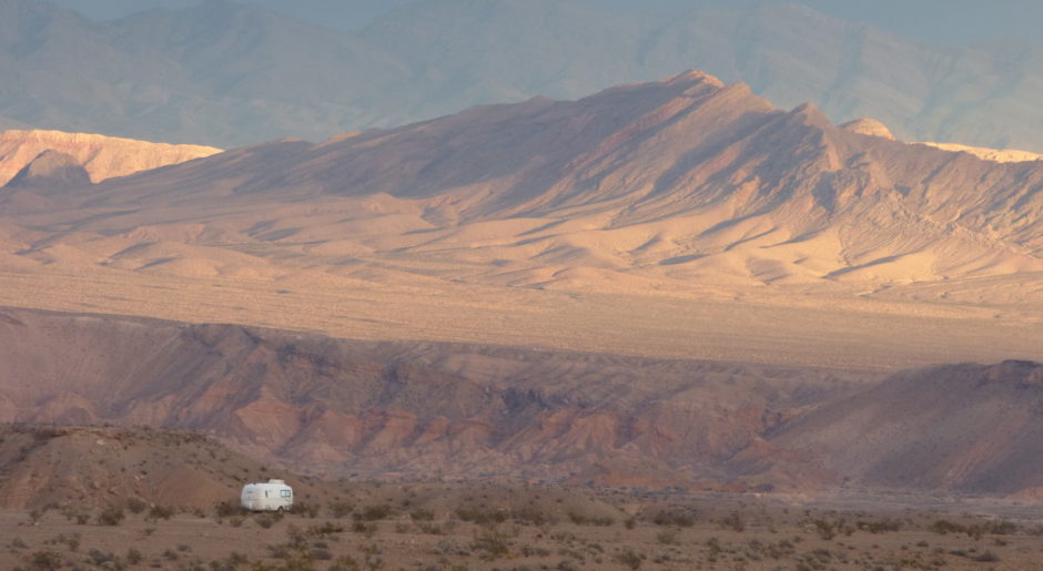
 Another time, another place, another storm — Pelican Lake, Utah, September 2014
CLICK LINK TO SHOP AMAZON NOW!

