Saturday, September 13
After nine days of campground living, I’m looking forward to a private boondock!
Bridget and I pull out of Popo Agie Campground in Sinks Canyon State Park, Lander, Wyoming, making one more crossing of the Popo Agie. Almost all the snow has melted.
 I gas up the Perfect Tow Vehicle at the Maverick station in Lander.
We begin our annual migration south on Route 789.
This route, along with Route 28, will take us around the southeastern tip of the Wind River Range and over the Continental Divide.
Not long after leaving the lively town of Lander, the homes and ranches become widely spaced, and then there are no more. Bridget settles down into a nap on the bench seat as we begin the long climb to Atlantic City, so named because it’s on the Atlantic side of the Divide.
I give the PTV a break at the Red Canyon overlook.
 “Time for a potty break, Bridge. It’s now or wait until we’re at our new home.”
 Bridget runs around, does her business, and we’re back on the road. Today’s journey is short. For this I am glad because most of the drive is upward. I think this climb is the longest we’ve ever attempted.
We drive past the turn to Atlantic City.
It’s a ghost town turned tourist attraction and I’m not interested in doing that today. Two campgrounds are accessed from that road — Atlantic City Campground and Big Atlantic Gulch Campground. My online research previously informed me that I should skip the campgrounds.
Instead we’re going to boondock.
Not far past the Atlantic City area, we make the right turn onto Louis Lake Road. This is Shoshone National Forest. (I know this from studying my Benchmark atlas.)
The gravel road goes over a small hill.
Immediately on the left are two campsites which are occupied. I wouldn’t camp there if they were empty. Too worn out from overuse. Also, all the traffic on Louis Lake Road goes by here.
We continue up the road a short distance and discover the third campsite. It’s also on the left. I park and walk to investigate.
A large area under the pine trees has been worn to bare ground.
All undergrowth is gone. Fire rings are smashed. Trees are scarred. Broken limbs are scattered about. Typical lets-play-ring-around-the-pine-trees destruction by OHVs. Nope, not staying here!
We continue further and the road forks in a grassy area.
To the left I see three big fifth-wheels tucked into the edge of the woods. No, that’s not for us either.
You might be thinking I’m becoming discouraged at this point. Not so!
This is where the real adventure begins!
Once past the places where OHVers and big rigs park in the forest, the really good boondocks may be found.
Note: When Bridget and I arrive it’s sunny and bright. By late afternoon the landscape is burnished gold by the sun. Unfortunately I didn’t take photos then! The photos that follow were taken early the next morning when the light was dim. I post them anyway so I’ll have a record of the boondock’s location and to help anyone who would like to camp here.
 The road sweeps down a hill, curves at the base, and crosses a meadow before disappearing into the forest. Before descending the hill, I get out to survey the situation. I don’t want to drive deep into the forest for a one-night camp, and I also want to be sure I can turn around, if necessary.
Hmm . . . Looks like there’s a stream going across the meadow, what with all those willows (barely visible in the above photo).
 Sure enough, there’s a small bridge at the base of the hill. I bet there’s a forest road along the stream . . . .
Bridge is awake and excited.
“It won’t be long now. If my guess is right, our home is down this little hill.”
Sure enough there is a forest road! I drive it and come upon a campsite next to the stream. Pine trees give light shade. Willows grow around the site. It’s a level pull-through. Perfect!
Except for one thing. . . .
Someone has parked their truck in the campsite! Gee, I wish day-use people wouldn’t do that! It’s probably a fisherman or a hiker.
Not one to give up, I get out and walk down a path into the willows at the stream, hollering, “Helloooo? Helloooo?”
A fifty-ish couple appears, apparently hikers. I ask about the campsite. No, they aren’t spending the night and they’re leaving now. Good!
I pull in, set up, and take a break in the lounger by the little stream.
 Later Bridget and I enjoy a long walk across the meadow.

We follow the dirt road along the border of the meadow. Right before the road goes into the thick forest are two good campsites. We climb a small hill and at the top we sit on a rock for a rest before heading back to camp.
A sign at the bridge says “Slate Creek.” The creek is much wider at the bridge than at our camp where it is a narrow, softly gurgling stream (below).
 I’ll call this boondock “Slate Creek Camp.”

 (In the photo above, those aren’t fumes coming from the PTV. That’s warm air from the muffler meeting the cooler air of morning.)
Sunday, September 14
After a good night’s sleep camped in the silent forest (overnight temperatures in the low 40s), Bridget and I are up and moving early. Since I didn’t unhitch or set up a full camp, we are back on the road by eight o’clock.

I drive southwest past South Pass City, across the desert, and through the town of Farson, where we turn south onto Route 191 toward Rock Springs.
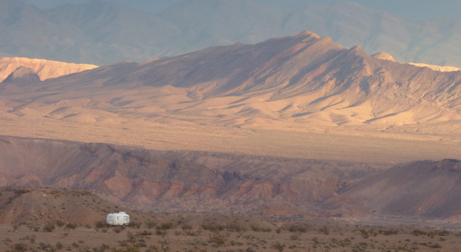
By mid-afternoon Bridget and I are settled into one of the prettiest and most private boondocks of our vagabond life!
rvsue
NOTE: I went into a lot of detail about how I found Slate Creek Camp for those readers who want to know how to find their own private camps.
I APPRECIATE EVERY AMAZON PURCHASE MADE THROUGH MY BLOG!
Thank you very much.
THIS LINK TAKES YOU TO AMAZON NOW!

