This is the second post today, so if you’re checking in late, be sure to catch the previous entry.
Can you guess where rvsue and her canine crew went today?
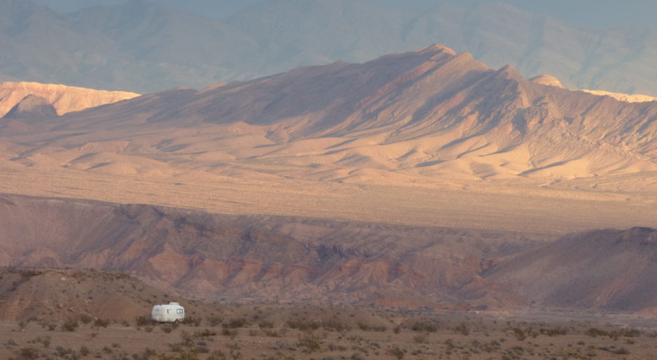
[slideshow]
Hints:
1) The road is so steep for so long that I have to stop in a pull-out to let the engine cool. I leave the PTV running and turn on the heater. These strategies, given to me recently by blog readers, work! I watch the needle drop into the normal range and get back on the road (only because I have no other choice).
2) We go through a free range area. We approach cattle in the road who take their sweet time getting out of the way, and then they look back at us with indignation.
3) We reach the summit of 9,114 feet.
4) I will never, as long as I am in my right mind, drive this road again.
5) We’re still in Utah!
rvsue


I love it! “4) I will never, as long as I am in my right mind, drive this road again.”
I guess that does leave it open……
Why do I keep tormenting myself? I didn’t take photos of the worse parts. Too busy hunched over the wheel talking to the PTV and cussing at the road.
Well, if you are still in Utah you’d have to be headed to Wellington. If you are going up over Douglas Pass you are in Colorado. I don’t see any other roads north other one just inside Utah but my map says it’s unpaved. You look like you’re on a paved road.
You’re on the right track!
I don’t know where you are, but the skies look like they are courting rain!!! Look out for muddy roads! Rain would certainly be welcome here! Glad you arrived (wherever you are!) safe and sound! Your new camera is taking nice sharp photographs! Love them!
highway 139 headed up to Rangely CO?
Nope.
We got a few sprinkles, that’s all. The sky is still overcast where we are.
Just dawned on me…..you are past Wellinton and headed for Duchesne…any way you are on 191. From Vernal, Utah north is supposed to be wonderful. I’ve never been there but heard about it.
You got it! Very good, Joy! The crew and I are spending the night in Duchesne. You’re not going to believe the site we’re in and it’s free! More about that in the next post . . .
That is the same 191 we were talking about when you were here Sue, it also leads south thru Utah into AZ and straight down to Mexico….. Chuck and I took that same drive twice… both up and down and beyond Wellington to Flaming Gorge on the Utah/Wyoming border! Closer we got to Flaming Gorge, we saw a herd of Dahl Sheep climbing straight up in a row up a steep cliff side! We also saw pronghorn sheep herds all along that road. You still got some climbs coming if you stay on that road, but beautiful country not to be missed! You are in for some of God’s eye candy country for sure!
Question . . . Would you (or anyone reading this) say that the road from Vernal to Flaming Gorge is a more difficult climb than the road from Price to Duchesne? I need to decide where to go from here. I’m reluctant to push the PTV beyond her limits.
If I remember right, if you have made it up Wellington, there is a long straight climb to Duchesne (we were coming down both times!!!), after that it levels out pretty good until you get to Verneal, from there, lots of short ups and downs until Flaming Gorge, then it will be mostly down and real curvy. Amazing to see it from that angle, you can really see why it’s called Flaming Gorge! I’ll ask Chuck if I got it right, I think I do! He’s still in bed!
It’s not a long straight climb from Wellington to Duchesne. It’s a very curvy, steep climb up and down and then levels out to Duchesne.
ooops! sorry! I was sure I remembered it right! I have a teflon brain, nothing sticks to it!
Hope that your white knuckles are finally pinking up!! I had to get out the atlas to find you this time. I have been wondering what kind of gas mileage average you get while pulling your little eggie. (Let’s not count while going straight up a mountain tho!!)
I’ve got a bunch of gas receipts with the odometer numbers on them. I keep forgetting to calculate that. Thanks! I’ll do that before the sun sets in Utah. I promise!
Oops! I think it already has.
Sue, Bet your bus driving was nothing like this…..
How’d you know I drove a bus? Did I mention that somewhere? If so, you’ve got a great memory, Joe. Better than mine!
I recognized the climb up onto Horse Bench (at the beginning). There’s a great boondock spot on a road that takes off to the left just across from the new rest area at the top of the hill (in fact, lots of them), but the gnats are bad there this time of year. I then wasn’t so sure, but I was ready to guess Duchesne. I haven’t been up that road for years. There are a couple of nice state parks near Vernal. My sister was married in Duchesne years ago, I have no idea why, as she lived in NW Colorado – oh wait, his parents lived there. Wow, takes me back! Hope you’re having fun – you’re close to Northern Ute country. One of my geology pals is the tribe geologist. She knows her stuff, too.
I am having fun, Chinle. “Horse Bench” — I love the names of places in the West. Funny, I wouldn’t have thought of that area as good for boondocking which makes it a good place (not obvious!). I saw some roads in the Ashley National Forest (which is misleading because it’s mostly rock, not trees) that could lead to boondocks, but the area didn’t appeal to me.. . too much dust and kind of desolate.
PS Sue, you went through Price, right? They have a fantastic dino museum there. Then you went through Helper and past the power plant, I would guess. I’m thinking of moving to Price for the winter so I can take some more geology classes at the branch of Utah State U. there.
What little I saw of Price, I liked. I did drive through downtown on Main Street. It looked like a lively place without being too wild. I was on 191 and there was a junction. I thought I had gone the wrong way when I saw a sign, Salt Lake City. In the West, make a wrong decision on the road and drive an hour or more to the next exit! So I exited and found myself in the downtown area. I asked and was told I should have kept going on that road.
I took a geology course at the Univ. of GA. It was okay, but I bet geology would be a lot more engaging when studied in Utah.
Hi Sue, you just passed on some interesting information in your blog. I did not that if you turned on the heater in your car you could cool it down that way. A very good thing to know. Thanks
Laura,
A person can learn a lot by reading the comments section of my blog. I do!
I learned how to help an engine cool down from readers Hatman, Wayne, and Ron. They gave me advice after the PTV ran hot recently.. Read their comments below “Upper Kent Lake, Utah!” for details.
FOUL !!! THROW A FLAG !!! BLOW A WHISTLE !!!! No fair asking questions about roadways I have not been on yet…. I’ll have to do something about that some day.
Now, Mark . . .Settle down . . . I think you just want to get out on the road!
Nina (Wheeling It) wrote of a boon docking spot near or in Flaming Gorge a while back. You might want to ask her or check her blog. Beautiful country for sure. I *think* not far into Wyoming is a town called Centennial. The first time we were west we went through Flaming Gorge and stopped in Centennial and stood in awe of the vastness that is the west. Enjoy, Sue.
Very helpful. . . I’ll check her blog.
Sue, one thing, now that you’re getting into wetter higher places, check the pups and yourslef for ticks periodically, esp. this time of year.
Oh yeah, being from Georgia, I know about those nasties. I appreciate the reminder.
Glad you enjoyed it. I like to change things up once in a while.
I’m thrilled with my new, free camp. I wanted to show the photos of the road to this place so in the next post I can concentrate on showing the photos of this little gem of a dry camp..
rvSue,
I don’t want to make disparaging remarks about your PTV but it has a heating problem. You have probably noticed this! HA
However, you seem to attribute it to the roads that you have had to climb rather than a problem with the cooling system of PTV. If you have not already decided to have it checked out I would suggest that you do so. Maybe in SD before you start back south?
Ed . . I don’t know if it has a heating problem or not. I may have given the impression that it’s in bad shape. I am very cautious and conservative when driving. The PTV’s temp. rises on these very steep, prolonged, climbs but I’ve never let it get in the “red zone.” I stop and pull over well before it gets that hot, and then it cools down.
It wouldn’t hurt to have it checked. I’m not terribly concerned right now. Of course, that statement may come back and bite me!
I was up the steepest of passes, Sue, and no overheating. At least you have water on board if after cooling down, you need it. I’m with Ed. I’d get it checked, too. It’s a shame to miss the most beautiful roads because of hills.
Were you towing at the time?
Yes, I was towing on some passes over 10,000 feet. I’m looking at my Mountain West Directory to see if I can find what it says
Utah Hwy 44 between Manila, UT and the junction with US191 About 12 miles south of Manila there is a descent for north bounders. Beginning near milepost 16 there is a 5 mile 8% grade with 30mph curves. Use caution on this hill.
US191 Highway between Flaming Gorge Dam and the junction with tab Highway 44 – Just north of the junction of 191 AND 44 – Just north of the junction of 191 and 44 there is a sign for northbounders-“Downgrade next 5 miles.” The 5-6% grade stair steps down for about 2 miles where there is a brake check area. The next 3 miles are steady 6% downgrade with 20 mph curves and a bridge at the bottom of the hill.
US 1919 Highway north of Flaming Gorge Dam
Between Flaming Gorge Dam and the Wyoming state line there are numerous short rolling hills as steep as 6-7%. They are usually 1 mile or less in length. For those coming south on 191 through This Wyoming there is a sign “9% grade next 2-1/2 miles”. This sign is near milepost 547 or about 4 miles north of the Utah state line. There are several miles of 3-4% descent before reading the steep part of the grade. There is a runaway truck ramp about milepost 548 1/2. It exits to the right and goes uphill.
US 191 between the junction with Utah Highway 44 and Vernal, UT – “Snowtires or chains required Nov 1 to Mar 31” About 9 miles south of the 191-44 junction, there is a summit (8428 ft). The northbound descent from the summit continues almost 9 miles back to the junction but it is rolling hills in the 4% range except for the last mile which is about 6% descent.
The southbound descent from the summit begins with about 6 miles of rolling grade, some of which is 5-6%. About milestone 220 1/2 there is a brake check area for south bounders and several warning signs–“5-8% grades — “10 switchbacks next 9
miles” and “truck speed limit over 10,000 lb 30 mph”
There’s a good deal of 8% grade included in the descent and the switchbacks are posted at 20 mph. Use caution on this hill.
I tried to reply to your very helpful comment yesterday. I loaded a YouTube video (time-lapse) of the drive to the Gorge and it took a lot of my power, which made my laptop pouty, refusing to let me post a comment. So I watched tv instead.
This is great information. Thanks for taking the time to post it here. I’m not very enthused about driving to the Gorge. I appreciate you looking up specific details for me.
Best to know what you’re comfortable with, Sue, and only you know that. Whichever way you decide to go, have a great time.
Flaming Gorge is bueatiful. I was there many years ago when I lived in Wyoming. One of the places I want to see again.
I may end up taking another route and skipping Flaming Gorge this year.
Sue, we make the climb north of Vernal to Flaming Gorge on a regular basis. From your comments, I’d say it will be steeper than you’d want to do. It’s very steep with numerous hairpin turns not far north of Vernal. But it’s the way to Jackson, WY, and the Tetons, then Yellowstone. You can bypass the climb by heading west to Heber City, UT, on Highway 40. Go north and pick up I-80 eastbound. You’ll head into Wyoming and be where you would have been had you done the very steep climb to Flaming Gorge. Now there’s nothing you can’t handle going north to Jackson, WY, and the Tetons.
The Desert Scruff . . .
The alternate route you mention — Hwy 40 to Heber City and then 1-80 eastbound — is exactly what I’ve been considering. In fact, the woman at the National Forest office suggested the same thing. It adds a lot of miles, but there’s always new experiences along new-to-me roads that will make the trip worthwhile. We probably could go straight to Flaming Gorge from Duchesne without any problems. However,, that kind of driving is not fun and puts extra wear and tear on the PTV.
I do appreciate you writing from your experiences on the road to Flaming Gorge. Your comment is very helpful. Thanks.
Probably too late…but there is another route you can take. Vernal to Craig, then north to Baggs WY and on up from there into Jackson. All easy driving, but not as scenic as the route near Park City.
Help me out. What direction to Craig? I can’t find it on my map. I’m probably looking right at it.
Sue, go east into Colorado after you get to Vernal. Craig has a great City Market and other stores on the end of town you’ll come in (don’t take the bypass if you want to find the stores). You turn north at the stoplight and head to Baggs, WY. The road is two-lane, but easy and well travelled, but not overly so. Baggs has nothing except gas, so stock up in Craig if you go that way, cause it’s a long ways to Rock Springs, WY which is where you get off the freeway and continue north to Jackson. (You get on the freeway north of Baggs and go back west to Rock Spgs.)
Mountain West shows that’s a good route, too, Chinle. Boy, you people sure know your way around. I never know what road I’m on. I got the Mountain West Directory (which I wish I could send to Sue), but didn’t have to use it with my truck. Still, it’s always nice to know what’s ahead of you.
I know my way around a very small part of the country LOL. But that’s my hometown country Sue’s in, so it’s on my radar for sure. Take me to a city and I’m lost.
I can tell you what towns I’ve been in, but as soon as I’m off a highway I can’t tell you what number or name it was. I got on some roads where the height scared me because of no room between me and air, but I had power in the truck so that was one thing I didn’t have to worry about. I did go down a road once that just ended with ditches on either side. That was interesting. :)))
You’re so lucky to have lived in the west. If I am ever able to get up and walk, again, I’m headed out, again.
Google search for 9,114 feet mountain pass on a road in Utah and it will show you the road and everything. On Hi way 9 just outside Hurricane Utah
I remember it well, Ben! I camped right off Hwy 9 between Hurricane and Virgin. Actually in Virgin. I bet you’re enjoying your travels in that area . . .
9,114 ft. is the mtn. we drove over yesterday. I’ll take a Google look at the road north of Vernal. It looks worse than yesterday’s climb according to my landscape map.
I can’t see Craig in my Atlas-is there another town nearby, Sue?
Carig is due east of Vernal about 60 miles. In Colorado. I grew up there. 🙂
Oh, Ha! Now, I know how you knew all that so well. 🙂
I think Sue can do the hills, I’m just a little concerned about the overheating.
Thanks, Chinle, very much for suggesting I drive to Craig. I’m seriously considering that route. It would get me over to SD sooner (postponing the Grand Tetons) and be less stress.